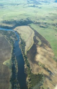
What is Land Capability Classification?
Why do we use it in Tasmania?
The idea of only using land within is capability or capacity is an American idea which came out of the disaster of the Dust Bowl event. This was a massive period of wind erosion across Oklahoma, Texas and Kansas in the early 1930’s. The widespread erosion was due to unsustainable and intensive cropping of wheat and corn driven by lowering commodity prices and rising land costs – the only solution for debt ridden farmers was; more intensive cropping. Then when ‘the big dry’ weather struck the massive soil erosion events began – the topsoil came to town as it were. Note similar things have been happening in Australia and in China over recent years; namely increased massive dust (soil) storms.
The solution proposed was a system of land classification and proposed use which focused on ranking it from arable down to low intensity pasture use. The original USA system has eight classes (8), the Tasmanian system only seven (7). The idea being to encourage farmers to only use land within its capability ranking. They are briefly given below but more detail is provided in the LAND CAPABILITY HANDBOOK by Chris Grose of the DPIWE (1999).

Class 1 = High quality arable farming land with no or only minor limitations to cultivated uses – its flat, well structured, free draining, non-stony and fertile soil. The land also has no or very minor climatic limitations (frosts, drought, high winds etc).
Class 2 = Very good quality arable land with minor limitations to cultivated uses – gently undulating lands with well structured soils, good drainage and moderately fertile soils and few climatic limitations
Class 3 = Good arable land but on rolling slopes or with other limitations which lead to soil erosion or other limitations to use e.g., frost, low rainfall, erosion due to slope or weaker soil structure etc.
Class 4 = Marginal arable land with slopes which are moderate, weaker soil structure, more drainage issues or climate issues etc…..this is the lowest class of arable land BUT it is excellent pasture land or forestry land.
Class 5 = Non arable land, but good pasture land. Cover is critical to keeping the soils from eroding. The limitations for use of the land might include climate, topography, erosion or poor stony of weakly structured soils.
Class 6 = Lower class pasture lands, again this land is non-arable and prone to erosion if ever cultivated. The land might be stony, steep, with shallow soils and any number of climatic limitations also.
Class 7 = Non arable lands and these are areas of very steep land, rock outcrop or swamps and salt flats.
With in the system it is also possible to list the primary limitation to use these include in order of importance:
E – Erosion be either wind, water or mass movement.
W – Water-logging and flood prone areas
S – Soils limitations like stoniness, salinity, poor soil structure etc.
C – Climatic limitations such as frost, droughtiness or high temperatures.
LAND SUITABILITY
While governments and NRM bodies encourage farmers to adhere to this system of land ranking and use land with in its class, this is not always appreciated. Many farmers provide irrigation, balanced fertilizer use and minimum tillage and through this believe they can utilize land at a higher capability level with superior land management. Certainly a regional irrigation scheme will improve the land capability class if droughtiness is the primary limitation – by about 1/2 to 1 whole class.
Farmers and investors generally prefer a land suitability assessment for a specific type of use. This type of land ranking compares a specific crop type and its requirements against the soil and land types available to score them from HIGH to LOW or MARGINAL suitability and also to list the key limitations to use e.g., the major and minor limitations like erosion or stone content or acidity etc.
